Digital Publication
A spatial interface to twenty essays on the objects and themes of the exhibit as well as the objects and landmarks
More information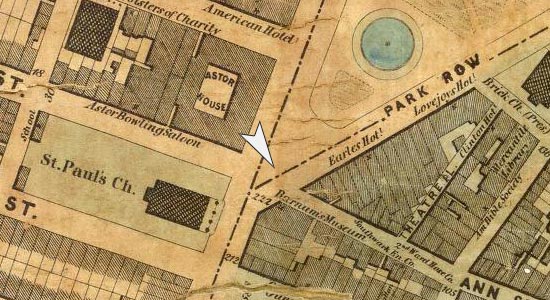
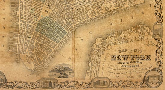
Broadway & Ann
The important landmarks that stood at this important Broadway intersection over time and by site
More information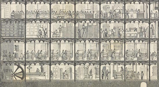
Behind the Scenes
A look at the technical processes along with the men and women who made all these cultural commodities in New York
More information